Chapter 1: An Introduction to QGIS
Part II B: Setting the Project’s Coordinate Reference System
Since Earth is spherical in shape, mapmakers use something called a map projection to flatten the globe onto a flat surface in order to make a map. A Coordinate Reference System (CRS) defines a map projection. So, we choose a CRS, and it sets a map projection for our project.
Perhaps one of the best-known map projections is the Mercator projection, which was developed in the sixteenth century.
Here is our OpenStreetMap layer set to the default CRS—EPSG:3857 WGS 84 / Pseudo-Mercator, which is a Mercator projection.

While the Mercator projection succeeds in displaying the spherical globe on a flat surface, it distorts the size of the world’s landmasses. Areas far away from the equator, such as Canada, are inaccurately enlarged in relation to areas nearer to the equator, which remain accurate.
In the past century or so, mapmakers have been trying to create alternatives to the Mercator projection. The goal is to create ones that avoid some of the distortion that the Mercator projection causes.
We will set the CRS of our project to one that accurately represents Prince Edward Island, for that is our area of focus. If we were mapping another region, such as the contiguous United States, we could set our CRS to one that is specific to that part of the world.
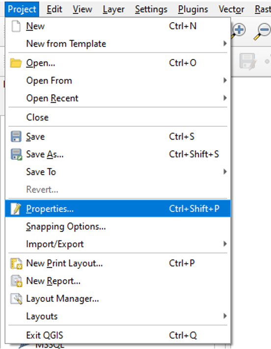
To set our project’s Coordinate Reference System:
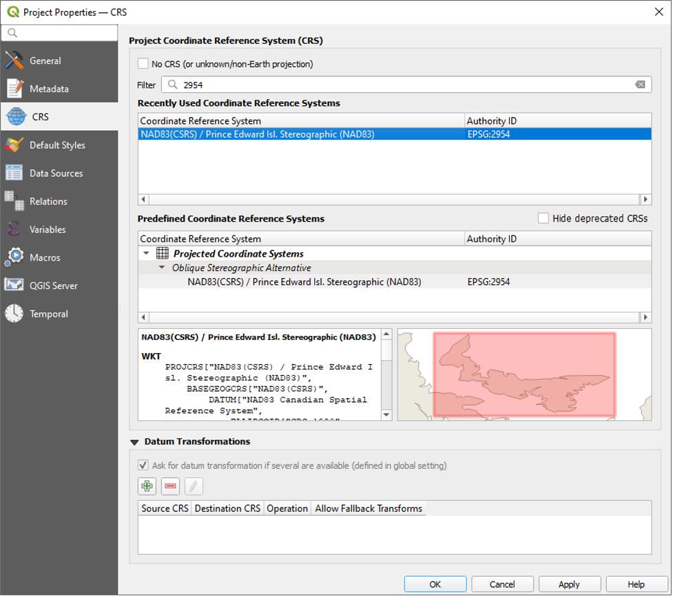
- Click Project, then Properties, then CRS.
QGIS has a small preview screen that shows you to which area your CRS is tailored. Currently, the CRS is set to the default—EPSG:3857 – WGS 84 / Pseudo-Mercator.
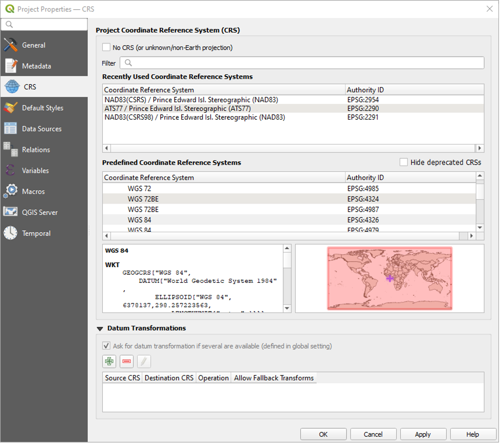
- Type 2954 into the Filter search box.
- In the Predefined Reference System area, click to highlight the search result called NAD83(CSRS) / Prince Edward Isl. Stereographic (NAD83). It has the Authority ID called EPSG:2954.
- Click OK.
The following window will pop up. It asks us to select a transformation.
- Select the first transformation option and click OK.
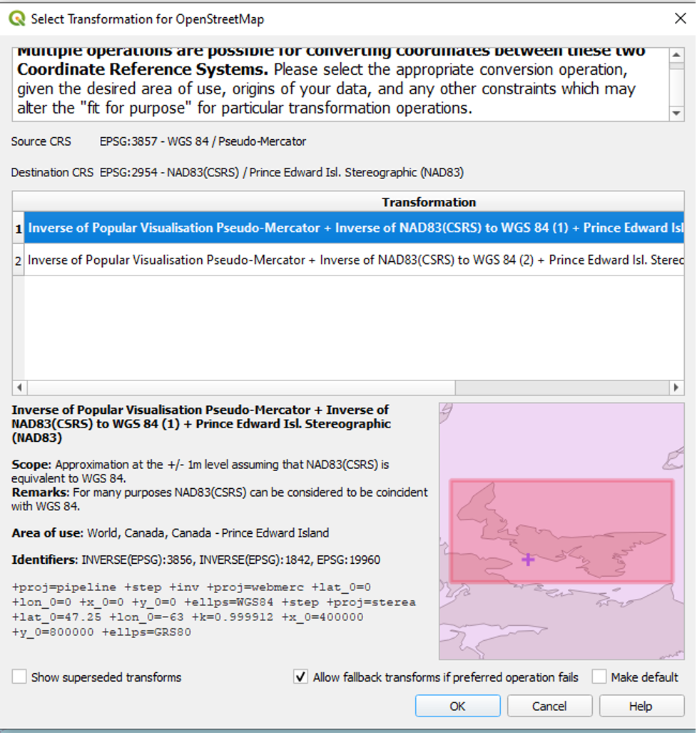
We had to choose a transformation because the default CRS of the OpenStreetMap layer is different than EPSG:2954, the one we just set for our project. QGIS will use the transformation setting we just chose to project the OpenStreetMap layer in the project’s CRS. In fact, if we add any more map layers that have a CRS different than that of our project’s CRS, QGIS will reproject these layers in the project’s CRS too. This process has been termed “on-the-fly projection,” and it is a strength of GIS software. On-the-fly projection will ensure that, notwithstanding a layer’s default CRS, all layers that we add to QGIS will display according to the project’s CRS. This is critical, for it ensures that there is consistency in how all the layers are presented.
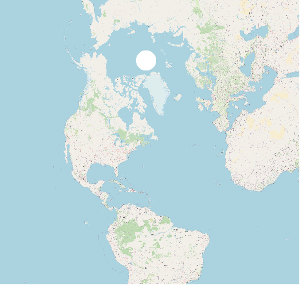
Here is the result of setting our project’s CRS to EPSG:2954. Canada is much more accurate in size and shape, although the focal point has become Prince Edward Island.